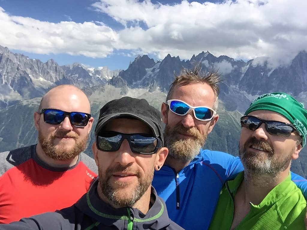
It is our third summer adventure in the Mont Blanc massif for Dave C and myself. We now have a good understanding of the cable car & ski lifts in the area and how they significantly improve access into the high mountains. This year we are joined by two friends and competent climbers Dave H and Ben. The plan is to get a few steady multi pitch rock routes in first on the Aiguille Rouges at circa 2000 metres before heading up to the high mountains above 3000 metres. Our strategy is to build confidence on rock and aid our acclimatisation. We already have several routes planned for the week, but are prepared to change these depending on current weather conditions, overcrowding and the stability of the snow.
It’s not supposed to rain here
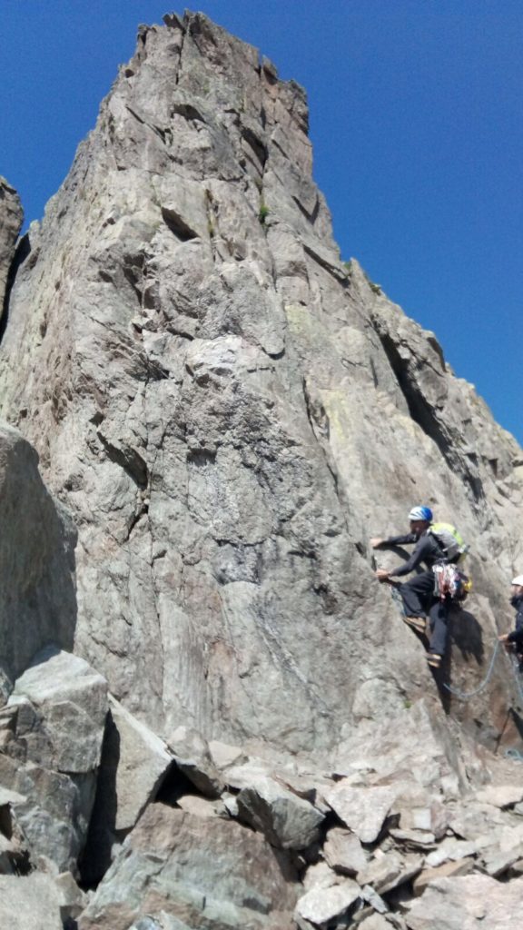
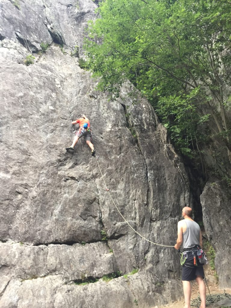
Our first morning is greeted with the arrival of rain, not the start we had anticipated. The four of us sit in a bakery in Chamonix centre drinking coffee whilst watching the thunder and lightning show outside. We discuss alternative plans ranging from via ferrata, a jolt through the MB tunnel into nearby Italy, or even heading north for forty minutes into Switzerland for some sport climbing. As luck would have it, the rain suddenly stops and the sun comes out from behind the clouds. Decision made, its back to plan A, to take the Flegere lift up to the Index for some Gneiss multi pitch climbing.
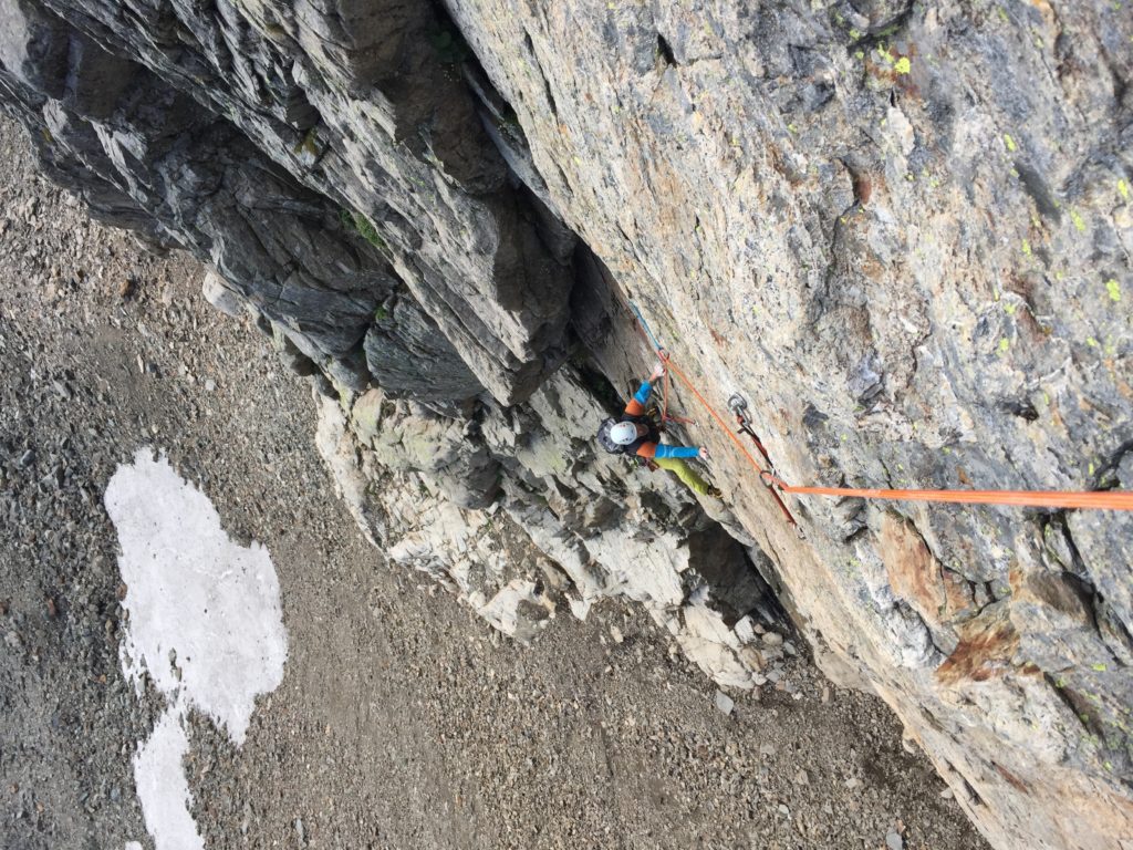
We split into two teams, Team 1 – to climb Nez Rouge (D 5A) a six pitch, 180-metre climb. Team 2 – to climb the fantastic South East Ridge (AD 4C) of the Index, a six pitch, 130-metre route with a series of exposed abseils. Dave C and I will tackle Nez Rouge on the Aiguille de la Gliere having previously enjoyed the South East Ridge a few years back. Ideally we will get to the top of our route first and snap a photo of Team 2 standing on the summit at 2595 metres. As we’re the only climbers on the mountain today, we ascend with no delays and get our photo of Team 2 at the summit.
Big Boots on Le Brevent
Our second day starts with the usual deciphering of the weather forecast, Chamonix Meteo appears to be the most accurate for the area. The plan today is to tackle a route in a different region wearing mountaineering boots. Mic est maousse AD+ 5a, a 5 pitch, 105 metre climb on Le Brevent. We set off early, keen to start before the crowds arrive and get back down before the late afternoon/early evening thunderstorms arrive.
We take the Telepherique du Brevent to the top station just below the summit at 2525 metres and follow an adventurous, scenic, descent route for approximately forty-five minutes to get to the start of the climb. We make good use of the in situ iron ladders to down climb where necessary. Unlike North Wales’s snakes and ladders all the rungs are in place and they’re firmly bolted to the rock. As we approach the base of the climb we can see a few groups above making progress up the initial arête.
Looking at the terrain we agree to move together initially and only pitch the steeper more exposed ground as required. Its pitch three before a belay plate makes a brief entrance for an exposed ramp and steep corner, which Dave C makes light work of in his Scarpa phantom lights. It’s a final scramble along the ridge before descending down to the foot of the crux 5A pitch. We stop here for lunch, and enjoy the view across the valley overlooking the snow covered Mont Blanc massif; the sun is cracking the flags.
It’s my lead on the next pitch. A tricky layback start leads to a groove that is well protected – the climbing steepens above to a hand jamming crack and exposed flakes to finish. A 20-metre abseil off the top leads us to a final ridge – once again we move together to complete the route and then head back up the track to the summit of Le Brevent. “Ice cream all round I believe”! As we return back down to the valley floor via the ski lift we see the dark clouds gathering way in the distance, we’re happy with the time it’s taken us today.
A tricky layback start
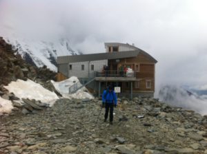
Bed & Breakfast at 2702 metres
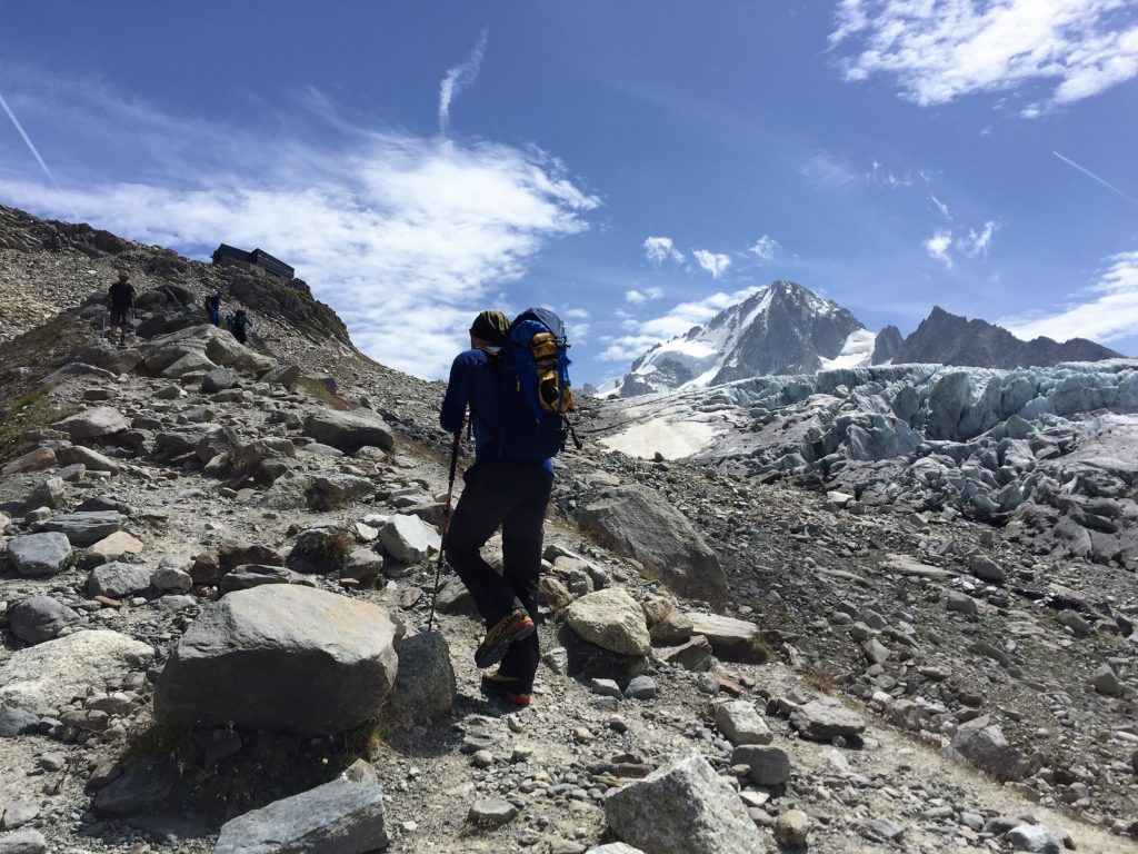
With a few rock routes at altitude now under our belts it’s time to head for the high mountains. Our plan today is to take the bus to the end of the valley to Le Tour and head up to the Albert Premier refuge where we’ll stay for the night. We have done our homework and spoken to the Chamonix Compagnie des Guides, so have a plan in place. The route we have in mind has seen some recent ascents, so we are fairly confident of summiting if conditions are still good. If not, we have a plan B and C just in case… The walk up to the hut takes in some stunning scenery, which flanks the glacier de Tour, presenting us with cascading white water falls, huge crevasses and a clear view of the Aiguilles Rouges on the opposite side of the valley. We can’t help but stop and take photos at regular intervals.
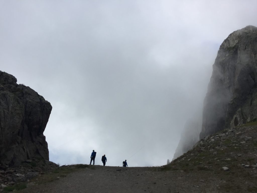
Day trip to Switzerland anyone…
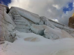
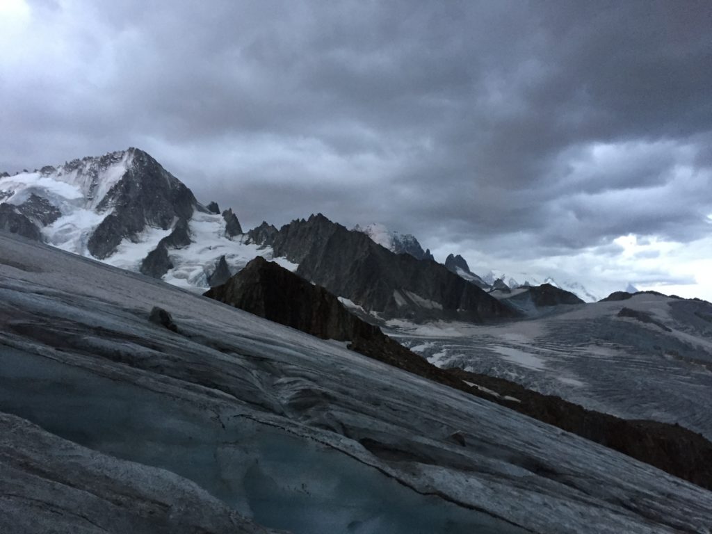
The following morning we start with a 4am breakfast before heading off up the scramble behind the hut heading for the glacier. We rope up as a four on a flat boulder field; ahead, the glacier is scoured, with little snow evident. We push on into the darkness heading south eastwards – our next feature a significant band of rock running east to west, which we need to cross at its furthest eastern point. Day light starts to break and reveals a moody sky with dark, ominous looking clouds heading our way.
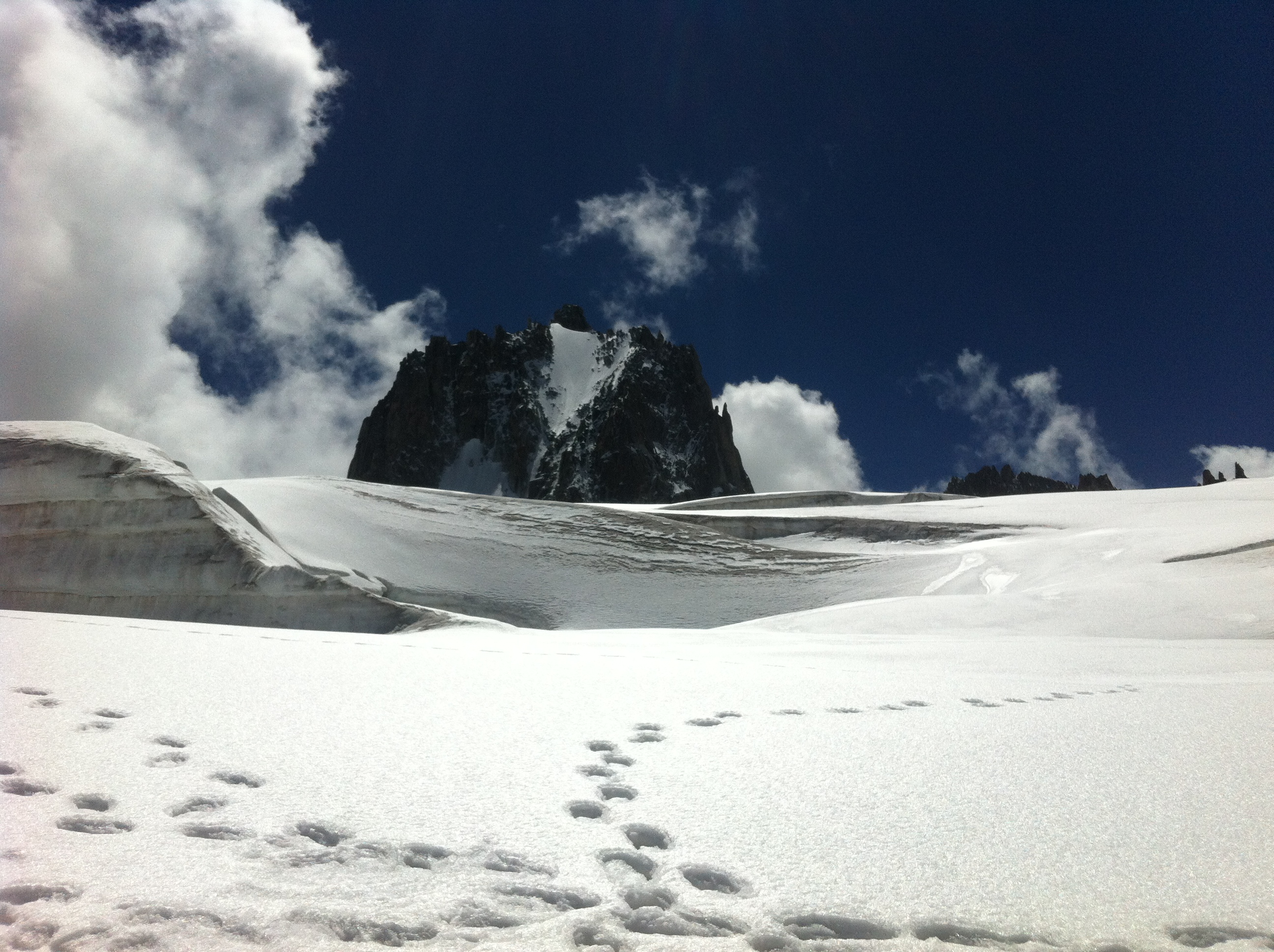
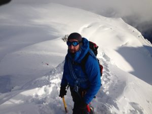
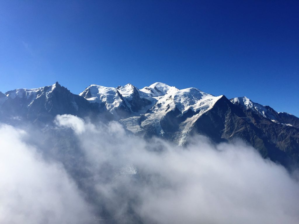
Our plan is to take on the Arête de la Table AD 5A, which is a six pitch 450 metre climb, and then on to the south summit of the Aiguille de Tour. As we pass beneath the granite cliffs we hear nearby rock fall from above; looking up we see large boulders bouncing down the mountainside. We continue, heading towards our entry point for the climb, the couloir. When we arrive, we note the snow is thin and the risk of further rock fall is too high to continue. So we revert to plan B, the south summit, which is a much safer alternative in these conditions. We move on together, the groups’ disappointment is evident, but we continue on crossing the glacier, past a huge tower of rock and up through the Col du Superior at 3289 metres. It’s a steep pull up through the col, the wind is howling through the gap and there is a fair bit of lose rock getting kicked off by other parties. We cross the col, entering Switzerland and reach the Trient glacier; we are greeted by bright sunshine and an eerie stillness. We head north, passing the Aiguille Purtscheller on our left. Access on to the Aiguille du Tour is restricted somewhat by a Bergshrund, we have to cross it at its narrowest point on the right hand side and then make a tricky traverse back above it leftwards to gain access onto the rock. We then scramble our way to the ridge, finally summiting at 3529 metres, and are rewarded by a spectacular view across the French and Swiss Alps. A few photos for the album and then it’s off again, heading back to the Charamillon col de Balme ski lift; lasts one is 5pm, loads of time…
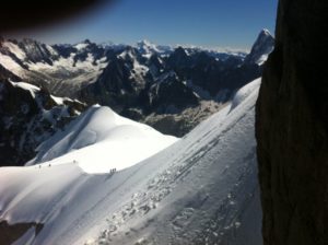
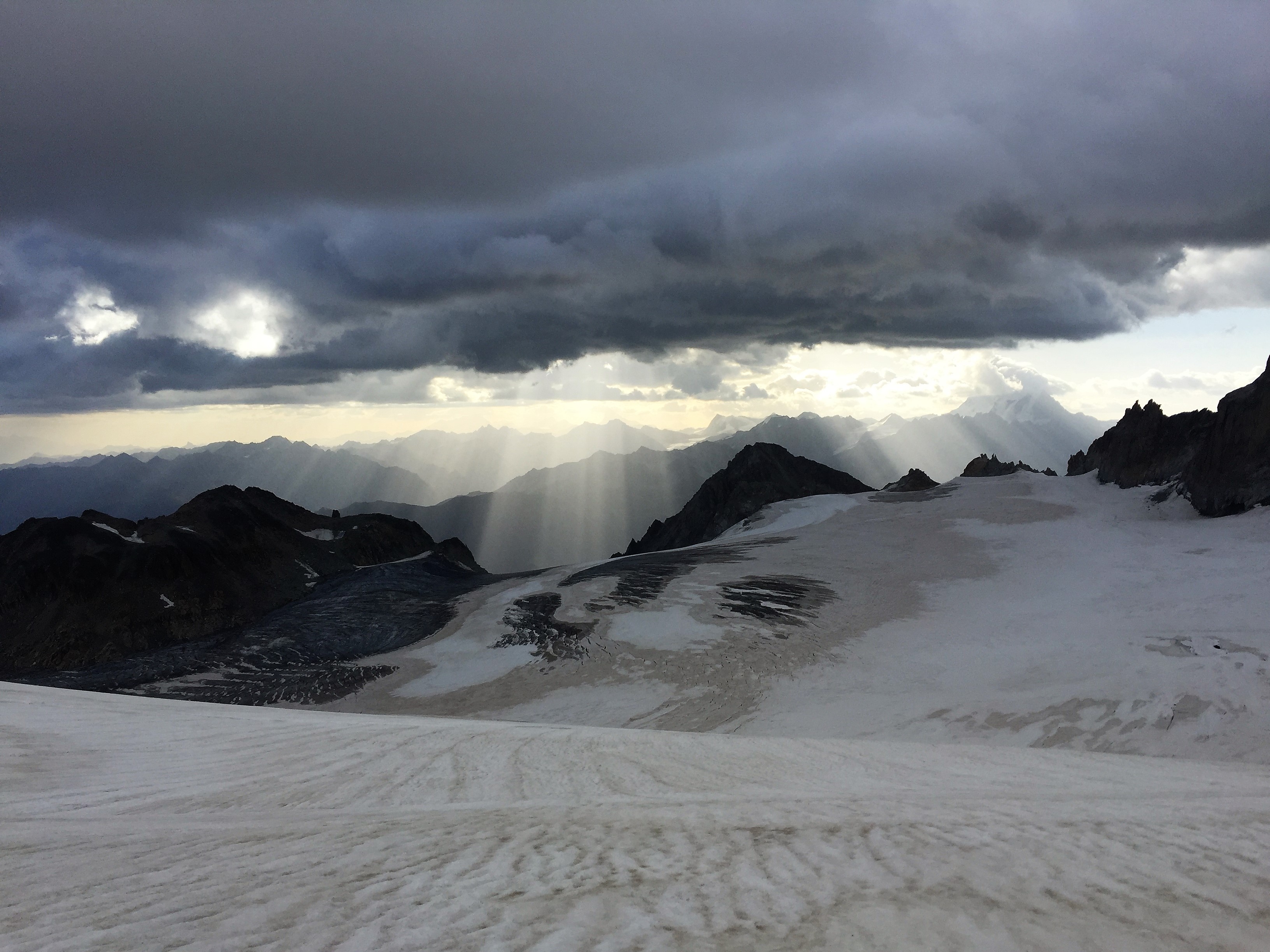
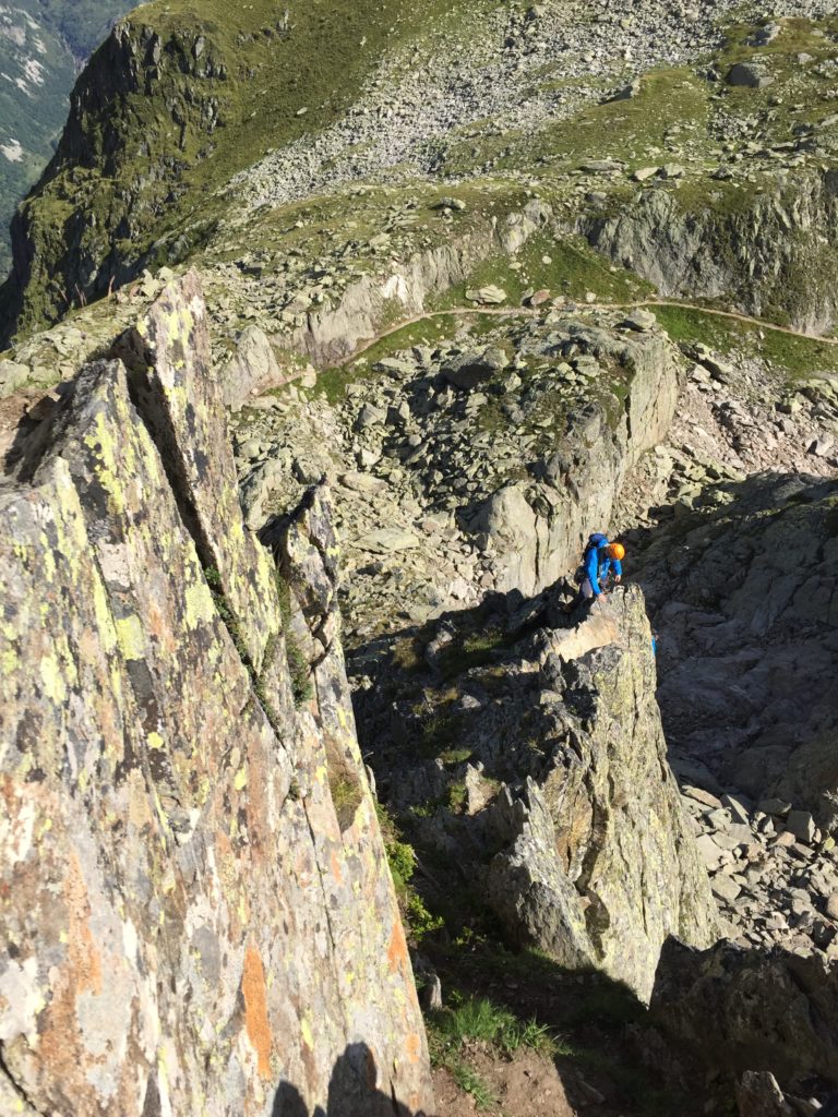
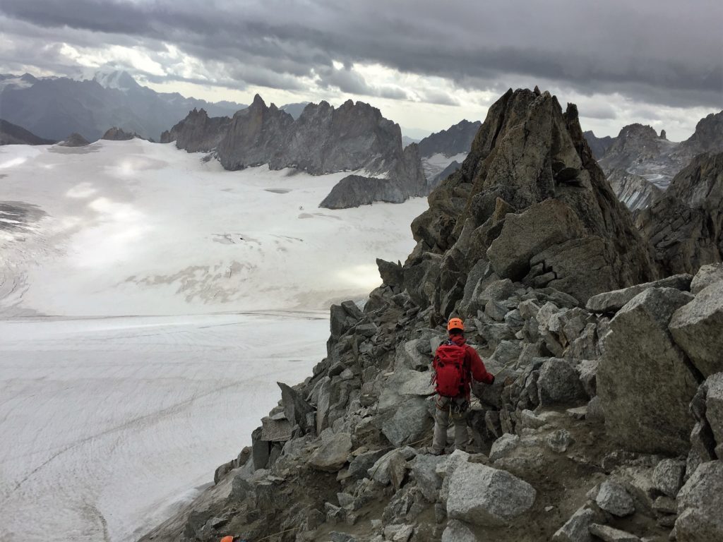 Heading down from the South Summit
Rest day or Not
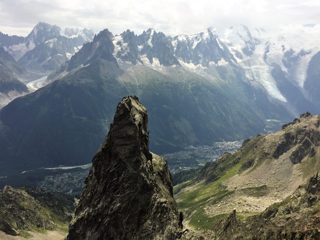
Today is a planned rest day so we make sure all alarm clocks are off following the previous early start and enjoy a lie in. We decide to have a leisurely stroll and explore Chamonix town centre and it’s plethora of restaurants, cafes and outdoor shops. However, by mid-afternoon we’re done and some easy sport climbing is suggested. Les Gaillands, Forestiers area provides the evening’s entertainment with over 20 routes, single and multi-pitch ranging from 4b to 6b+. Well worth a visit if you’re ever staying in the local area and fancy a quick roadside climbing fix.
Oops, here comes another adventure
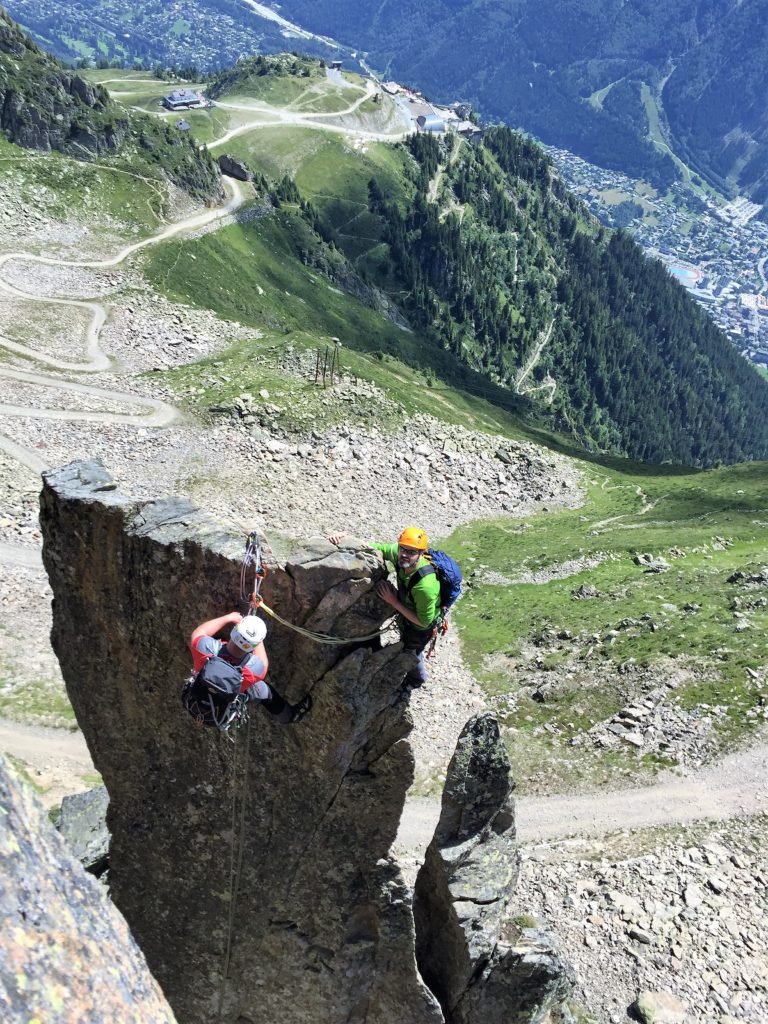
The weather for our final day once again looks great, we agree on something not too challenging, but enough to keep us entertained. La Somone D-5b on Le Brevent appears to be a good choice with eight pitches and 205 metres of enjoyable climbing. Once again we head off to the top station of Le Brevent ski lift. We then descend on foot into the clouds, passing two climbing crags and walk beneath the main cliff. We follow the track downhill until we arrive at the toe of a buttress and see a French guide and his client racking up. We assume this is our agreed route and exchange pleasantry with them before they set off and disappear out of sight.
Once again we rack up as two teams, Dave C leads off on the first pitch, which is steep but steady and seems a little harder than our guidebook suggests. I arrive at the belay and prepare to lead through. The guidebook says it’s a ten metre easy down climb, in reality it’s a 5A slab going up. “I think this part of the route has changed!” says Dave, as I start off. He’s right, this section doesn’t register with me either; but I carry on upwards anyway. Once at the belay point, I get the chance to speak to the French Guide’s client as he is just setting off. I ask quickly in my best French accent, “What route are you doing?” “Crackoukass”, he shouts down. “Yes, lovely climbing isn’t it”, I reply automatically. I’m actually thinking – Shiiit, we’re on the wrong bloody route and it’s the one we didn’t fancy doing, as it was three grades harder. At this point I also realise we don’t have the guidebook…
Minutes later, Dave joins me at the belay station and I inform him of the breaking news. He handles it well and is happy to lead through up the next pitch. We can see it’s an OK slab start but have no idea what grade it is or where it leads to. Half way up and Dave shouts “which way?”, his inclination is to go right. I reply “I think it’s left and then straight up!” After some deliberation, the sport climber in him takes over and he tackles the slab head on. It looks tough, but he battles his way up on some tiny crimpy holds, managing to get a cam in for some protection; before long he is at the top red faced and out of breath. “Good effort pal, are you safe?” I shout. “About as safe as it gets, I’m on top of a f**ing pillar!” I hope there’s enough room for two of us up there, I think, as I start to climb. A short while later, after bridging my way up through a chimney (I take the trad route), I join him on the top. Believe me, it’s definitely not designed for two! The only way off is to untie from the rope and abseil off. Fifteen minutes later, we’re both stood on a shelf looking back up at the huge pillar of rock; we can hear Ben on the other side, battling his way up the pillar.
We now have two options: make a series of abseils to try and retrieve our rope and bail off the route, or tackle what we believe is a 6A corner leading to a large hand jamming crack. We both agree the corner looks like a great pitch – I take the lead, onwards and upwards for another fifteen metres of fantastic rock starting with a layback crack. I stop halfway up and manage a hands-off rest, perched on top of a flake. I snap a photo of Ben and Dave H on top of the pillar – then continue on – I arrive at a large belay ledge and bring up Dave C. From here we can see an easy down climb/scramble and a great spot for lunch; we’ve certainly worked up an appetite!
Within a short while all four of us are sat on the rocks laughing at the situation we had just got ourselves out of. We settle for the relatively easy last two pitches up the exposed arête of La Somone; the finish to our original planned route that leads to the summit. It’s about two hours later before we’re sat outside La Bergerie de Planpraz, at the half way ski lift station, enjoying a well-deserved cold beer and taking in the magnificent vista overlooking the Mont Blanc massif.